Every tree located, numbered and measured — DBH, height, crown and species assist — on the plan and in the table Miami-Dade, Broward and Palm Beach ask for. LiDAR and drone capture for wooded or large sites, signed and sealed by a Florida Professional Surveyor & Mapper.
Add boundary and topography on the same plan, same visit. Serving 20 counties from the Keys to Tampa Bay.
Send the address or folio and what the county or your architect requested. A licensed surveyor replies with a price and a delivery date.
Thank you — a licensed surveyor will review the property and send your quote within one business day (usually much sooner). If it's urgent, call us at (786) 574-6608.
Want to walk through the scope while we prepare it? Book a 30-minute video call with a licensed surveyor.
The crew that captures the site and the surveyor who seals the tree plan work in the same office; the species assist is done in the field, not guessed from the cloud.
A licensed crew captures every tree with survey-grade control. Small lots take one visit with the total station; wooded or multi-acre sites are flown with LiDAR so nothing is missed under the canopy.
Surveyfy AI locates each trunk and measures DBH, height and crown spread; the surveyor checks species, multi-trunk trees and the ones the county cares about.
Tree plan with numbered symbols, the tree table in the county format, per-tree sections when required, and a signed and sealed PDF plus DWG — in 2 to 7 business days.
The plan and the table the county reviewer, the arborist and the landscape architect need — in the same file set as your boundary and topo.
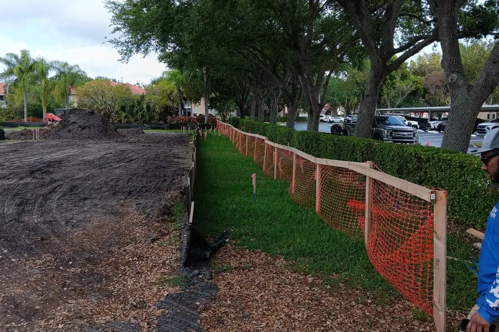
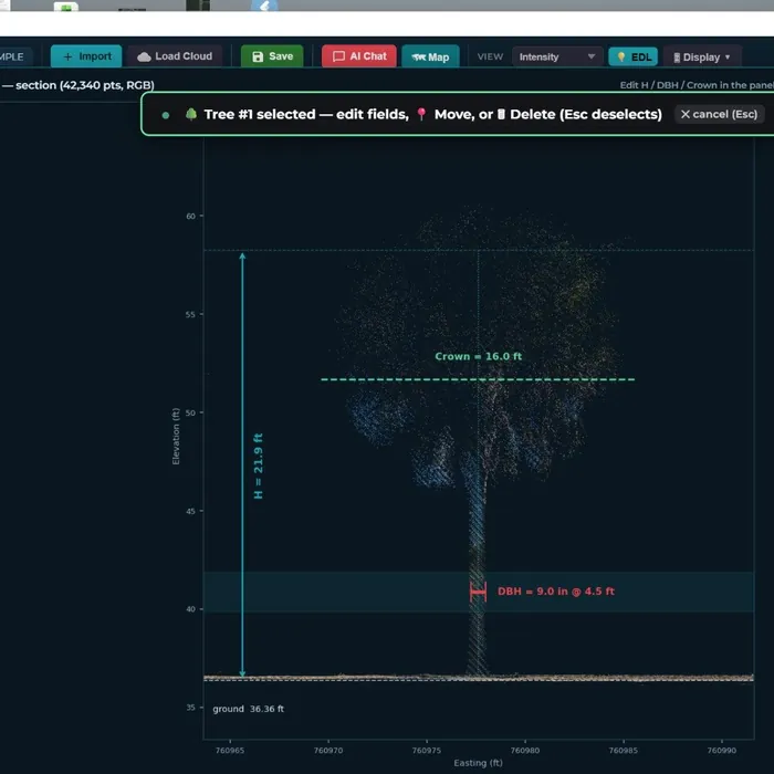
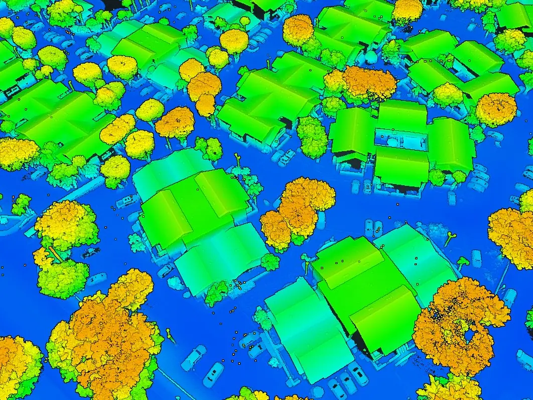
Most permits that ask for a tree survey also ask for the boundary and the topography. We capture all three in the same visit and deliver one signed and sealed plan, so the architect, the landscape architect and the county are looking at the same drawing — and you pay for one mobilization.
We deliver in the county's format and talk to your arborist or landscape architect directly when a tree needs a second look.
Tree plan and table in DWG on the same coordinates as the site plan, with canopy and critical root zones when the design needs them.
Tree surveys for site plan approval, removal permits and mitigation calculations — from a single lot to a wooded multi-acre parcel.
The tree survey Miami-Dade, Broward or Palm Beach asked for with your pool, addition or demolition permit, delivered in days.
 Surveyfy AI · in-house software
Surveyfy AI is the software our own licensed surveyors built to turn LiDAR and drone data into drawings. For tree surveys it detects every trunk in the point cloud, measures DBH, height and crown, and builds the table and the per-tree section the county asks for. The surveyor checks the species and the edge cases, then seals.
Every output is verifiable, signed and sealed by a Florida Professional Surveyor & Mapper.
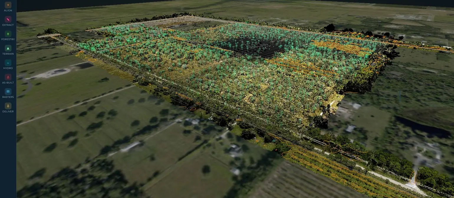
Two field crews and our own LiDAR and drone fleet cover South and Central Florida. Tell us the county and the lot size and we'll give you a real delivery date, not an estimate.
Crews based in Doral and downtown Miami. Orlando and Tampa Bay projects are scheduled weekly.
Miami-Dade, Broward, Palm Beach, Monroe (Florida Keys)
Martin, St. Lucie, Indian River (Vero Beach), Brevard
Orange, Seminole, Osceola, Polk
Hillsborough, Pinellas, Pasco, Manatee, Sarasota, Charlotte, Lee, Collier


















Anything else? Call (786) 574-6608 — English and Spanish.
The location of every tree above the county's size threshold (usually 3 to 4 inches DBH), its number, species, DBH, height, crown spread and condition, on a plan and in a table. Miami-Dade, Broward, Palm Beach and most municipalities have their own table format — we deliver in the one your reviewer uses.
For removal permits many counties require an arborist report in addition to the survey. We coordinate with your arborist (or recommend one) so the tree numbers and the disposition column match between the two documents.
Yes — that is our most requested combination for site plans and permits. One crew, one visit, one signed and sealed plan with the tree survey, the boundary and the topography.
With LiDAR from a drone or a mobile unit: the cloud captures every trunk under the canopy, Surveyfy AI detects and measures each tree, and the crew verifies species and the trees that matter. It is faster and more complete than walking the parcel tree by tree.
The address or folio, what the survey is for (permit, site plan, inventory) and, if you have it, the county requirement or the architect's request. We reply within 24 hours with price and delivery date.
A licensed surveyor reviews the parcel, confirms the county format and answers with a price, a scope and a delivery date.
